

Land north of Mansion House Farm, Abbots Langley (Three Rivers) Herts: Now grey belt
land.
Title sheet photo:
Land north of Mansion House Farm, Bedmond Road, Abbots Langley – Local planning
authority – Three Rivers
Appeal recovered by the Secretary of State for the Ministry of Housing Communities and
Local Government (MHCLG) and determined in May 2025 granting permission and citing grey belt as the rationale.
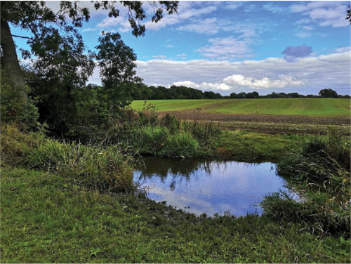
Agricultural land with two public footpaths running through the site.
Our grateful thanks to those who contributed to this paper:
Chris Berry
Abby Coften
Richard Knox-Johnston
Tim Murphy
Foreword
The London Metropolitan Green Belt (LMGB) as a planning policy has been hugely successful in containing the capital and preventing urban sprawl. In 1940 London and Los Angeles were of a similar area and if London had been allowed to sprawl to the extent that Los Angeles has grown, it would stretch from Brighton to Cambridge.
The LMGB has many economic, social and environmental benefits, apart from its role to restrict urban sprawl and encourage urban regeneration. It protects the capital from flooding and provides opportunities for carbon sequestration, nature regeneration and biodiversity. It provides important physical and mental health and welfare benefits for the city's inhabitants, and opportunities for recreation and sport as well as food security and rural activities.
The introduction of grey belt has already resulted in the loss of open countryside, often of high quality, as can be seen in the photographs in this paper. It is leading to speculative and piecemeal development with ten out of the twelve planning appeals in 2025 being allowed for proposed development in the London Green Belt where the sites were identified as grey belt.
These sites are not previously developed land, such as redundant petrol stations or car parks, as originally intended. The present definition of grey belt enables the revoking of protection of Green Belt, as is recognised by developers and their legal representatives.
The Government's grey belt policy is leading to the destruction of the Green Belt whose benefits will not be enjoyed in future. If this policy is not reversed, future generations will live to regret it.
Richard Knox-Johnston
Chair
The London Green Belt Council
Peter Waine OBE
Chair
CPRE Hertfordshire
Introduction
Green Belts are disappearing before our eyes…
A recent survey carried out for ‘More in Common’ for CPRE, found that nine in ten people want the countryside protected. Two-thirds of those surveyed saw the countryside as special and all the groups surveyed favour building on brownfield sites in preference to open countryside - but this is not happening.
There are also 1.4 million houses which have obtained planning permission since 2007 but are not yet built, and there are thousands of empty houses in our towns and cities which could provide much needed accommodation for young families and young working people.
Despite this, before the general election in July 2024, Labour Party leaders suggested that areas in the Green Belt could be developed instead of using vacant homes and vacant brownfield sites. Sir Keir Starmer drew attention to a redundant petrol station in Tottenham Vale and a car park outside Wolverhampton. Then Secretary of State of MHCLG (Angela Rayner MP) said in a new statement (July 2024):
“some low-quality Green Belt land will be freed up to become part of a 'grey belt' to allow new homes to be built..” (including) …”land on the edge of existing settlements or roads, as well as old petrol stations and car parks”
There was no mention of “low quality” Green Belt in the Labour Party Manifesto.
The Government then published the revised NPPF in December 2024 and grey belt was introduced and defined allowing building on Green Belt land without restriction. Developers and their legal advisers immediately recognised the opportunity.
Leading Kings Counsel (KC) acting for a developer in a recent planning appeal stated that:
“The Government’s approach to the grey belt within the Green Belt is a seismic reversal of the policy test that applies to hundreds and hundreds of sites all over the country’.
Another KC stated at the recent Marlow Film studios inquiry:
“With the grey belt policy in play, contesting such an application becomes virtually impossible. …The new Labour Government policy reclassifying certain Green Belt land as grey belt essentially neutralises the traditional protections”.
Further proof of what is actually happening is reflected in a report from consultants Marrons (Grey Belt Research for LPDF) on planning appeals between February to September 2025. This showed that 84% of Green Belt appeals were being approved compared with 40%, as an average, over the last ten years. Over twice as much Green 5 Belt is now being sacrificed to development and the situation in the LMGB is even more stark with, out of twelve appeals, only two were refused.
The loss of Green Belt is even more difficult to understand when Brownfield Land Registers, legally required to be compiled by councils and kept up to date, are showing that there is enough brownfield land for 1.5m homes. Many of these registers are out of date and considerably more brownfield is likely to be available. The Government claims it has a “brownfield first” policy but there is very little evidence that this is being observed.
The Government is not prepared to invest effectively in brownfield development and relies for future housing entirely on private sector developers who are already guilty of not building out despite possessing planning permission due to a lack of profitability.
The Treasury clearly sees the Green Belt as having no economic value unless covered with concrete, ignoring its crucial economic, social and environmental roles.
Executive Summary
- This report provides up-to-date information on the damaging impact of grey belt on the London Metropolitan Green Belt (LMGB).
- Before the 2024 general election, the Labour Party defined grey belt as redundant petrol stations and disused car parks only.
- In December 2024, the Government updated the National Planning Policy Framework (NPPF) introducing the grey belt policy that allows development in the Green Belt with little or no restriction.
- Most of the Green Belt land that has been designated grey belt is good quality countryside, as is shown in this report and Annex A. It is causing piecemeal development with little restriction and is a major threat to important countryside around London which provides many benefits including those for physical and mental health and wellbeing.
- From February to December 2025 there were twelve London Green Belt planning appeals. Ten were granted permission on grey belt grounds (83% where normally only 40% have been successful).
- Based on Treasury advice, current Government policy defines the economic value of Green Belt solely in terms of its potential for development. They also believe that by building more houses, prices will reduce which totally ignores market forces and other economic factors.
- The Government has a “brownfield first” policy which it ignores, since building on brownfield requires central funding. Yet there are over 500,000 homes on brownfield urban sites with planning permission waiting to be built. Much of the required infrastructure is likely to be already in place. This has the effect of depriving young working people of an affordable home.
- By adopting a grey belt policy which prevents consideration of two of the main purposes of the Green Belt (as set out in the NPPF); encroachment on the countryside and urban regeneration, encourages building on the Green Belt at the expense of renewing urban centres on brownfield land.
- Urban brownfield homes are likely to be at a higher density and so more affordable for young working people and families who desperately need housing.
- In Hertfordshire, out of 35 planning applications last year for development in the Green Belt, 89% were on sites identified by the developer cited as grey belt.
- The current definition of the “standard method” for calculating housing need is flawed and mistrusted. It is based on an “affordability” aspect which has yet to be evidenced and a supposition that by building houses prices will fall.
Grey belt definition
Grey belt as a term first appears in the revised National Planning Policy Framework (NPPF) 2024, paragraph 155 and more recently in Annex B - Glossary, of the new draft consultation NPPF December 2025 as:
Grey belt: “For the purposes of plan-making and decision-making “grey belt” is defined as land in the Green Belt comprising previous developed land (PDL) and/or any other land that in either case, does not strongly contribute to any of the purposes (a), (b) or (d) in policy GB2”.
The NPPF 2024 identifies five purposes for the Green Belt in paragraph 143, and these are repeated in the December 2025 draft consultation NPPF, Chapter 13 - Protecting Green Belt land - Policy GB2, as follows:
(a) Check the unrestricted sprawl of large built-up areas
(b) Prevent the merging of neighbouring towns
(c) Assist in safeguarding the countryside from encroachment
(d) Preserve the setting and special character of historic towns
(e) Assist in urban regeneration by encouraging the recycling of derelict and other urban land.
However, only three of these purposes can be used when considering whether Green Belt is grey belt or not. The two purposes which are removed in a grey belt assessment are:
(c) Assist in safeguarding the countryside from encroachment
(e) Assist in urban regeneration by encouraging the recycling of derelict and other urban land.
Purpose (c) is the purpose most frequently used as a reason for refusing planning permission in the Green Belt. Purpose (e) is a principal means of incentivising the use of brownfield sites, especially in urban areas where regeneration is urgently needed, as acknowledged by the Government’s “brownfield first” policy and the Pride of Place Programme (December 2025) policy.
It is purposefully illogical to continue to promote the five purposes of the Green Belt and only permit three of these purposes to challenge a grey belt designation. By omitting purpose (c), and despite Government statements on biodiversity, nature regeneration and access to green spaces, the implication is that the countryside is not to be safeguarded. This also implies that any countryside, of whatever quality, can be assumed to be grey belt and sacrificed for development.
Regarding purpose (e), implies that a “brownfield first” policy will not be supported by the grey belt definition. The Green Belt has long been responsible for encouraging urban regeneration which is urgently required and the removal of purposes (c) and (e) severely affect the planning balance required for planning decisions and plan-making.
The Hertfordshire experience
One of the counties most affected by grey belt so far, is Hertfordshire and a review by CPRE Hertfordshire has exposed just how damaging it has been for the Green Belt. Just over half of the County is Green Belt but certain Boroughs have a significantly higher percentage and major planning applications have been reviewed in three areas to indicate the impact of grey belt.
The table below shows three of the most affected council areas and the number of major planning applications in 2025, since the publication of the revised National Planning Policy Framework (NPPF) in December 2024. Many of these applications are still to be determined and are facing considerable local community opposition.


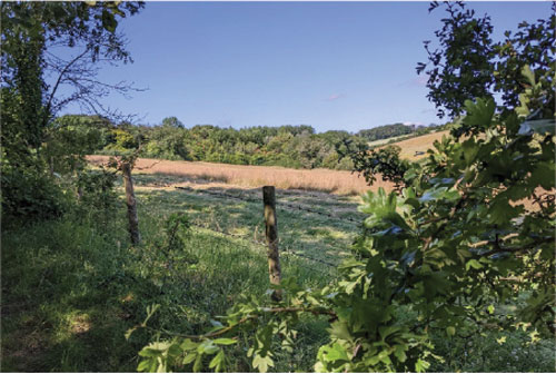
The above sites are not poor quality nor previously developed land and they are certainly not disused carparks, derelict petrol stations or abandoned garages. They are overwhelmingly highly valued landscapes, mostly agricultural land with public footpaths well used by residents and visitors alike.
Land West of Leighton Buzzard Road
A particularly bad case was allowing an appeal and granting permission in 2025, on land West of Leighton Buzzard Road, Hemel Hempstead (Annex A, example 1.0) where Fairfax Developments Ltd applied for permission for 400 houses on Green Belt. Dacorum Borough Council refused the application on Green Belt grounds, specifically encroachment onto the countryside.
The site is completely undeveloped open countryside, adjacent to a major nature and wildlife site, Halsey Fields, and crossed by several significant and well used public rights of way. The site includes nationally recognised Roman villa remains and constitutes the western side of the River Gade, a chalk stream subject to occasional flooding and in the setting of the historic village of Piccotts End.
The site formed part of the ‘green wedge’ which was a key element of the original planning of Hemel Hempstead new town, forming an attractive and important entrance way including the river valley into the main urban area. CPRE Hertfordshire, as a Rule 6 party at the inquiry, together with a combined objector’s group, argued that the site was self-evidently not grey belt and the proposed development clearly constituted serious encroachment onto high quality and highly valued Green Belt.
The developer’s counsel argued, amongst other issues, that the site was grey belt, due to its definition specifically exempting encroachment from being a permitted reason for refusal (NPPF Glossary), and the Inspector agreed with the appellant and allowed the appeal. This example is only one of many where the definition of grey belt is being used to enable development on high quality open countryside, thereby jeopardising the balanced consideration of economic, social and environmental objectives as still required by the NPPF.
Applications are continuing to be made throughout Hertfordshire, including for sites which were previously refused permission on appeal (Annex A, examples 2.0,3.0,4.0). This is leading to the major coalescence of villages and settlements, especially in southern Hertfordshire where ostensibly protected open countryside is being taken for residential and large-scale commercial uses, including data centres.
Standard method for calculating local housing need
In addition to the damage caused by the grey belt, the Government has also changed its “standard method” formula which must be used by LPAs to calculate housing need for Local Plan purposes and is the main reason for losing greenfield sites to development, especially in the Southeast.
Housing need is calculated by taking the existing housing stock in a local authority and multiplying it by a factor (0.8%) which enables the Government to reach its target of building 1.5 million new homes during the life of the current Parliament It is currently only achieving around 200,000 new homes per annum).
Using the existing housing stock to determine future housing numbers nationwide is arbitrary, and to add insult to injury, this figure is then supplemented by an affordability factor in areas where land values are highest. This is perverse and only justified by suggesting that requiring more houses to be built will reduce their price so allowing more lower income households to buy.
There is no empirical evidence that this is the way the housing market behaves in practice. Rather, developers and builders will hold on to land, whether or not it has planning permission, until such time that they can sell houses at the highest possible price to protect their profits.
The introduction of the affordability uplift, to reduce house prices, inevitably results in new housing development being concentrated where prices are highest, as in the LMGB and will continue to exaggerate existing discrepancies between levels of house building activity in different parts of the country.
The standard method is burdening LPAs with unachievable targets for housing, especially in the Southeast. The Government is being dishonest especially to “hard working families” about the potential success of their arbitrary housing target.
Deliverability (delivering homes)
Constraints on development are more concerned with deliverability than the planning process and comprise issues such as the number of unimplemented planning consents, affordability, lack of infrastructure and the present capabilities of the building industry.
Unimplemented planning consents and brownfield
Across England there are enough existing unimplemented planning consents, identified brownfield land, and long-term empty homes to achieve even more than the Government’s 1.5 million new homes target. This could be done immediately, without a further single new planning application in the countryside.
The Institute for Public Policy Research (IPPR) published research in February 2025 showing that developers have secured planning permission for more than 1.4 million homes since 2007 (and more than 1.1 million homes between 2010 and 2020) that have not been built. According to the IPPR:
“common reasons for this include developers wanting to increase the land’s value
before selling it on and land banking to slow building rates and maintain high house
prices.”
Rather than focusing on allowing the identification of Green Belt land as grey belt the Government should introduce measures to force developers to build on sites with planning consent, facing planning permission being revoked or paying an annual financial penalty. This would support the Government’s affordable homes target whilst protecting the green spaces needed to support health, local wildlife and the environment.
Affordable homes
The NPPF requires at least 10% of new homes in residential developments to be for affordable home ownership and this is typically mandated through local planning policies and conditions such as Section 106 agreements. LPA policies generally require a higher proportion and the ‘Golden Rules’ introduced by the NPPF 2024 require 50% affordable for grey belt applications.
Developers routinely can submit "viability assessments" to argue that, due to costs and profit requirements, they cannot meet the full affordable housing requirements. Such arguments, which are permitted by the NPPF, enable developers to reduce substantially the amount of affordable housing provided.
There is no legal requirement for developers to commit to the affordable housing requirements. This enables developers to get out of building the affordable housing desperately needed and, in England, only 64,762 affordable homes were delivered in 2024-25, just a 1% increase from the previous year.
Infrastructure
Deliverability should be linked to the timely provision of infrastructure, ensuring development is sustainable and supported by necessary services but the pressure to meet local housing targets often leads to approvals in areas where infrastructure is non- existent, causing issues such as overwhelmed sewage systems leading to river and sea pollution and severe strain on local services and facilities. The increase in the rise of greenfield developments in poor locations risks putting further pressure on already congested rural roads.
Section 106 agreements and the Community Infrastructure Levy (CIL) are not effectively enforced. Developers continually take advantage of this loophole and councils lack the legal leverage to enforce their agreements. The Government should hold developers accountable for not providing adequate infrastructure provision for all new build homes. Government should ensure the infrastructure is in place before development is started.
Brownfield land
A key Government policy commitment is the promotion of what is regularly referred to as “brownfield land”. This is now referred to in the draft consultation NPPF 2025 as Previously Developed Land (PDL) and defined in Annex 2 as follows:
“Previously developed land: Land which has been lawfully developed and is or was occupied by a permanent structure and any fixed surface infrastructure associated with it, including the curtilage of the developed land (although it should not be assumed that the whole of the curtilage should be developed). It also includes land comprising large areas of fixed surface infrastructure such as large areas of hardstanding which have been lawfully developed. ”
Availability
The availability of brownfield land is assessed by what is included in the Brownfield Land Register which every local planning authority is legally expected to maintain and keep up to date. However, councils do not appear to consider keeping the register up- to-date of sufficient priority, so many are not accurate and the Government does not enforce their maintenance.
As an example, the London Borough of Enfield in 2019, where the Register noted enough brownfield for 2,970 new dwellings. Research by members of the London Green Belt Council and CPRE London showed that there was enough brownfield in the Enfield LA area for over 30,000 new homes. When this research was shared with the LA, they agreed that they had underestimated brownfield housing and the total was increased to 29,000 homes that could be built on brownfield sites within the Borough: ten times the original figure.
In 2025 CPRE produced a report on the “State of Brownfield” . Its research was based on the information contained only in extant brownfield registers and showed that there was enough brownfield land for 1.4 million homes. This included just under 30,000 hectares of readily available land. The report also showed that brownfield was continuing to increase; by 54% in the six years to 2024.
Assuming that there are other LPAs with considerable areas of brownfield land, as in Enfield, the amount of brownfield could accommodate between two and three million homes, most of which could be affordable, so providing urgently needed affordable homes for young working people. This would greatly reduce the pressure on the countryside especially Green Belt. There should be proper in-depth analysis of the availability of brownfield land to ensure that all of it is properly recorded and used.
Delivering brownfield land
The Government has stated that their policy is “brownfield first” but does not take the actions that are needed to ensure the policy is carried out. There is a need for proper analysis as to the extent of brownfield land urgently releasing it for development.
Delivering development on brownfield sites is poor with the need for decontamination sometimes discouraging developers from building. Government must be realistic and make available funding for brownfield development much of which already has planning permission and could be started immediately. As much of brownfield land can be serviced by infrastructure already present, there would be an overall cost saving.
The Greater London Authority (GLA) alone has planning permission on brownfield land for 250,000 homes (CPRE Brownfield report). These are homes that are desperately needed, especially for hard working young people and families but are not being built. By analysing the amount of brownfield land, creating a positive lead to obtaining permission and investing in de-contamination the government has enough, more readily available, land which could make a considerable contribution to the housing crisis.
It also has to be noted that any development would regenerate urban centres, something the government is keen to encourage.
The future of the London Metropolitan Green Belt
London’s Green Belt has been very effective in stopping urban sprawl and providing a relaxing area for health and welfare. Its greatest asset, for those visiting, is the openness of the countryside and its attractive landscapes.
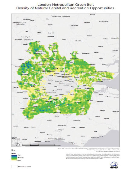
In addition, the Green Belt provides considerable natural capital which has important economic value to the country but especially to those who live in or around London (see annex E).
The list of benefits is considerable including:
- providing food, water, heat absorption, timber and minerals
- carbon sequestration, flood control, water purification
- recreational and aesthetic benefits
- soil formation and nutrient cycling, supporting agriculture and food
production - biodiversity ensuring ecosystem resilience.
By treating nature as capital, the Government can better account for environmental impacts in decision-making, aiming to prevent the overexploitation of resources. The London Green Belt has also been responsible for providing opportunities for recreation, not only for formal sport but for access into the countryside with:
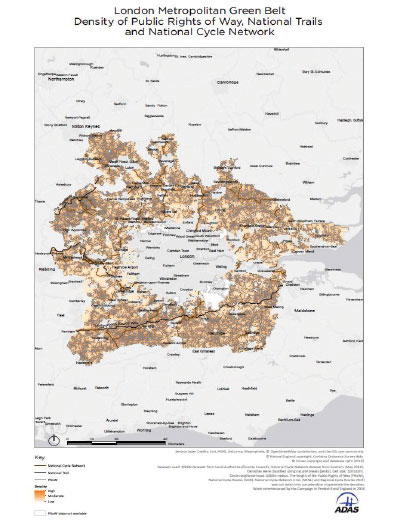
- 6,150 miles of public footpaths (Annex B).
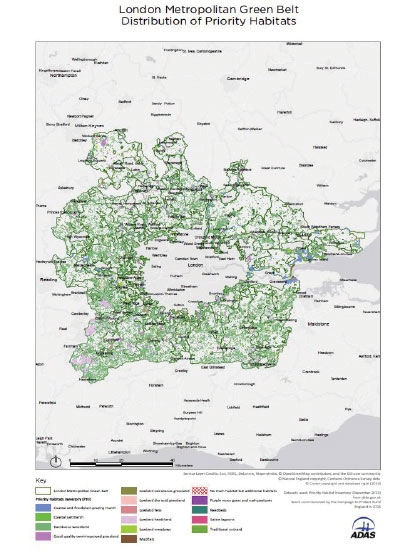
- Important priority habitats (Annex C)
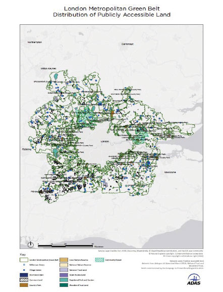
- Publicly accessible land (Annex D)
With the sudden problems created by the war in Iran, there is a lack of fertiliser and pressure on food security. This is going to have an effect on food production and an increase in cost. The LMGB is 508,500 hectares in area, of which 330,000 hectares are farmland, forest and green space. This need for agricultural land is going to become more important in order to support food security.
One phrase used in planning decisions, at all levels, is that the land is “poor quality agricultural land” , in spite of the fact that our forebears have used it for agriculture and grown food since medieval times.
If Government’s grey belt policy is unchallenged then no part of the Green Belt will be safe from development. Beautiful landscapes and even protected National Landscapes (previously AONBs) will be unprotected and this will inevitably lead to speculative piecemeal development destroying the benefits that the Green Belt brings.
In his book, “Repurposing The Green Belt in the 21st Century” , Professor Peter Bishop (UCL) states that there needs to be an overall strategic appraisal of Green Belts in their entirety, taking into account: “The Green Belt’s intrinsic quality on a hierarchy of nature conservation and ecology, water management, heritage protection, recreation, productive agriculture/horticulture, energy production and supportive infrastructures including waste and recycling.”
He ends the book, having set out the challenge on the way we think of cities in the UK, with:
“If we are unwilling to embrace these challenges and fundamentally change our approach, then perhaps we should leave the Green Belt for future and hopefully more responsible generations.”
Recommendations
- To reverse the grey belt policy and its definition
- To ensure that Green Belt is only released after “very special circumstances” have been proven, after considering all the five purposes of the Green Belt in Chapter 15 of the NPPF Consultation paper (dated December 2025) in GB2 “Assessing Green Belt land” paragraph 1 a to e.
- A strict adherence of the government’s “brownfield first policy” stopping development in the Green Belt until brownfield is exhausted.
- To conduct, thorough research into a more accurate analysis of the availability of brownfield land together with properly updating brownfield registers, showing the amount of land readily available for high density development with readily available infrastructure and at a price which is affordable for young working families and young working people.
- Realistic government investment in urban brownfield land with planning permission, so that it can be built out speedily for young working people.
- Protect high quality farmland from development so it can provide important food security
- To research the economic value of Green Belt for:
- flood prevention
- food production close to the capital
- carbon sequestration
- health and welfare
- recreation facilities
- tourism - The revision of the “standard method” to make it more accurate and believable by revising the affordability aspect and encouraging growth in the whole of England.
- To research the number of vacant houses and to invest in their refurbishment to quickly provide urgently needed homes and to remove VAT from the refurbishment cost so encouraging their repair
- To create a long-term strategy for the whole of the LMGB and supply investment to reverse the degradation some landowners have deliberately allowed.

Hertfordshire examples of planning applications citing ‘grey belt’.
Example 1.0
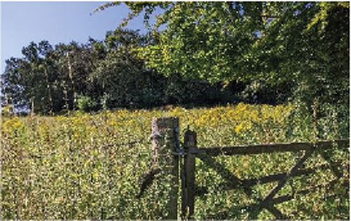
Location and site description:
Land West of Leighton Buzzard Road, Hemel Hempstead, HP1 3LP (Local Planning Authority (LPA): Dacorum Borough). Planning application 21/04508/MOA; Appeal reference APP/A1910/W/24/3345435 - 390 dwellings plus 70 bed care home, on 26 hectares
At appeal in early 2025, applicant argued site is grey belt and Inspector agreed, allowed appeal and granted permission.
Site is in the setting of the Chilterns National Landscape and lies on the western slope of the Gade River valley (the Gade is a chalk stream). Immediately to the east is the historic village of Piccotts End with numerous listed buildings and a conservation area. Immediately to the west is Halsey Field Local Nature Reserve. Immediately to the south is a Roman villa Scheduled Ancient Monument. The site is agricultural land (mix of Grades 2, 3b and 4). Two Public Rights of Way (PR0Ws) run through the site.
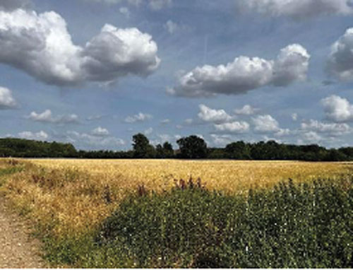
Location and site description:
Land Rear of Shottfield Close, Sandridge (LPA: St Albans District Council). Planning application 5/2025/1556 - 84 dwellings, on 3.92 hectares
Application argues site is grey belt. Awaiting determination.
Grassland field / agricultural land with one PRoW – The Hertfordshire Way long distance path - adjacent to northern boundary of site.
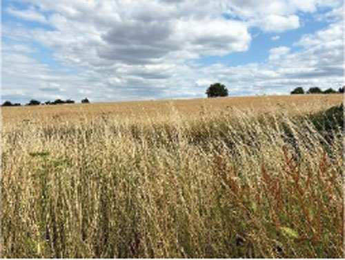
Location and site description:
Land North of Earls Lane, South Mimms (LPA: Hertsmere Borough Council). Planning application 25/1023/FUL - Solar farm of up to 30 MW, on 39.59 hectares.
Application argues site is grey belt. Awaiting determination.
66.8% Best-and-Most Versatile agricultural land (29.4% Grade 2, 37.4% Grade 3a). Mostly level landscape with long range views. The Catherine Bourne stream and three PRoWs including The Hertfordshire Way long distance path all run through the site.
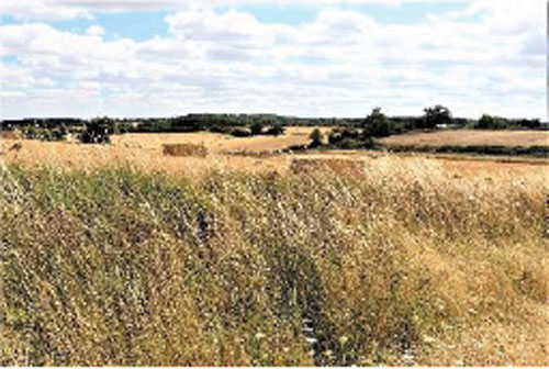
Location and site description:
Land Northeast of Wandon End (LPA: North Hertfordshire District). Planning application 22/03231/FP; Appeal reference APP/X1925/W/25/3359065 - Solar farm of up to 49.9 MW, on 106 hectares.
At appeal in early 2025, applicant argued site is grey belt and Inspector agreed, allowed appeal and granted permission.
Site is 51% Best-and-Most Versatile agricultural land (Grade 3a) with at least 6 PRoWs running across it. Undulating landscape with long range views in all directions. Site is also in an area that was proposed for inclusion in the Chilterns National Landscape. But the Chilterns National Landscape Boundary Review project was cancelled by DEFRA and Natural England in the spring of 2025.
List of major residential grey belt planning appeals, granted planning permission, in the London Metropolitan Green Belt from February 2025 to August 2025 (7 months)
21 February – Land at former Court Lane Nurseries, Court Lane, Hadlow (Tonbridge & Malling) for 57 dwellings
12 March – Land at Grove End, Bagshot (Surrey Heath) for 135 dwellings
2 April – Land to the east of Platinum Way and opposite Grange Road, St Mary’s Platt, Sevenoaks (Tonbridge & Malling) for 24 dwellings
11 April – Land south of Kenley Aerodrome, Victor Beamish Avenue, Caterham, Surrey (Tandridge) for 80 dwellings
15 April Land adjoining 451-469 Daws Heath Road, Hadleigh, Essex (Castle Point) for 173 dwellings
24 April – Former Weylands Treatment Works, Lyon Road, Walton-on-Thames, Surrey (Elmbridge) 40 dwellings
9 May – Perrysfield Farm, Gibbs Brook Lane, Broadham Green, Oxted, Surrey (Tandridge) for 29 dwellings
17 June – Land west of Chapel Road Smallfield, Surrey (Tandridge) for 270 dwellings
5 August – Land west of Leighton Buzzard Road, Hemel Hempstead (Dacorum) for 390 dwellings
6 August – Land east of Chase Mews and west of 310 The Chase, Benfleet (Castle Point) for 47 dwellings